Basemap manager
The basemap manager is used to manage basemap layers accessible from project 3D views.
A basemap is a 3D representation of geospatial data used in project 3D views as context or as reference data. It is made of a Digital Terrain Model and a georeferenced image.
Your project must be georeferenced to be able to add basemaps.
ContextCapture can create basemaps from terrain and image data downloaded directly from Bentley’s GeoCoordination Services or from local terrain and image files.
About Bentley GeoCoordination Services
GeoCoordination Services is a geospatial data indexation service that allows you to easily find and download available data on your project area. It allows you to request the list of available data on the area, and get a selection of data for your project.
GeoCoordination Services proposes data on the following countries: USA, Canada. More countries will be covered in future versions.
GeoCoordination Services if a service reserved to Bentley CONNECT users. You must be logged in with Bentley CONNECT Edition to use it.
Notes: The GeoCoordination Services URL can be changed from ContextCapture Options. By default the following URL is used: https://connect-contextservices.bentley.com/v2.3/Repositories/IndexECPlugin--Server/.
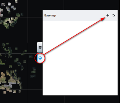
Opening the basemap manager from the block 3D view layers menu.

The basemap manager window
To add a new basemap, click on Add in the Basemap manager window, or directly select Add basemap from the layers menu in the 3D views.
Name
Basemap alias
Enter your preferred name for the basemap to be added.
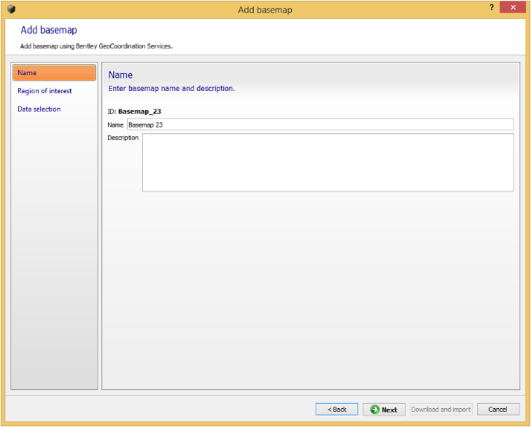
Adding basemap: the name page
The name can also be changed later from the basemap manager dialog.
Region of interest
Select the bounding rectangle of the basemap to create. The region of interest is used to request data from GeoCoordination Services, and to crop the selected input data to the area of interest.

Adding basemap: the region of interest page
For blocks with existing photo positions, the initial region of interest is automatically set to contain all the positions with a margin. To change it you can edit bounds in the coordinate system you want, or import a KML polygon.
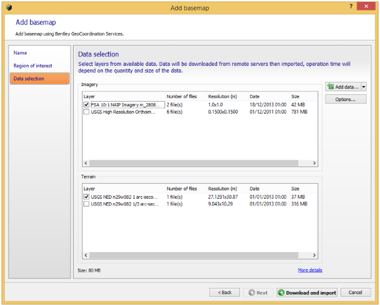
Data selection
Select the list of data used to build the basemap.
The list of data contains spatial layers found by GeoCoordination Services on the given region of interest,
Adding basemap: the data selection page
Click on More details to get on overview of the selected data.
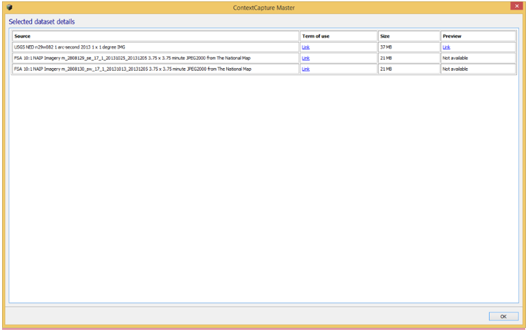
Selected dataset details
You can also add local terrain or image files.
Supported local files are:
For terrain: raster DTM with known registered coordinate system in the following file format: GeoTiff, IMG. ASC.
For imagery: Image file with known registered coordinate system in the following file format: GeoTiff, JPEG2000, JPG, ECW.
Options:
Discard data outside the region of interest (default: activated): if disabled all the selected input data will be kept.
Height reference for input terrain file (default: Mean Sea Level): select the height reference for input terrain files. Most terrain files are based on Mean Sea Level, however we recommend to use terrain file based on the WGS84 ellipsoid to avoid precision loss when importing heights.
Select the list of layers to use to create the basemap, and click on Download and import to proceed.
ContextCapture starts by downloading data from remote servers if required, then process the 3D terrain model cache for rendering. Operation time will depend on the quantity and size of the data.
Example of a basemap created from GeoCoordination Services data